Showing posts with label Seven Summits. Show all posts

Sunday, August 23, 2015

Kilimanjaro Trekking 7 Days Machame Route


Machame Trekking 7 Day Itinerary


You will enjoy the more comfortable and easier to acclimatize 7 day trekking on the Machame Route of Kilimanjaro. This is the route itinerary I did in 2009, reaching the summit on January 1, 2010.

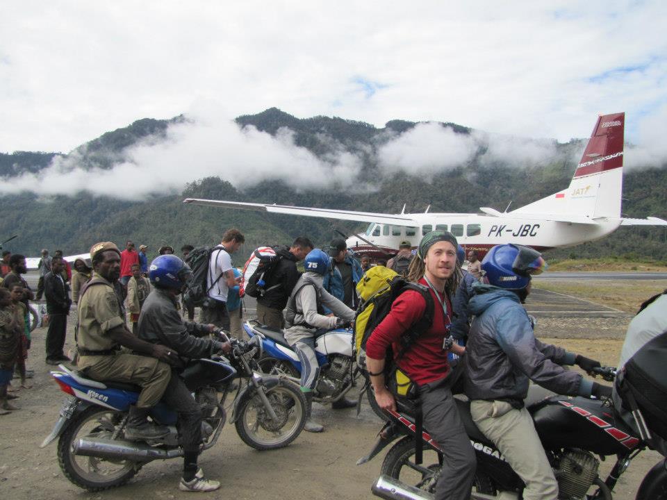
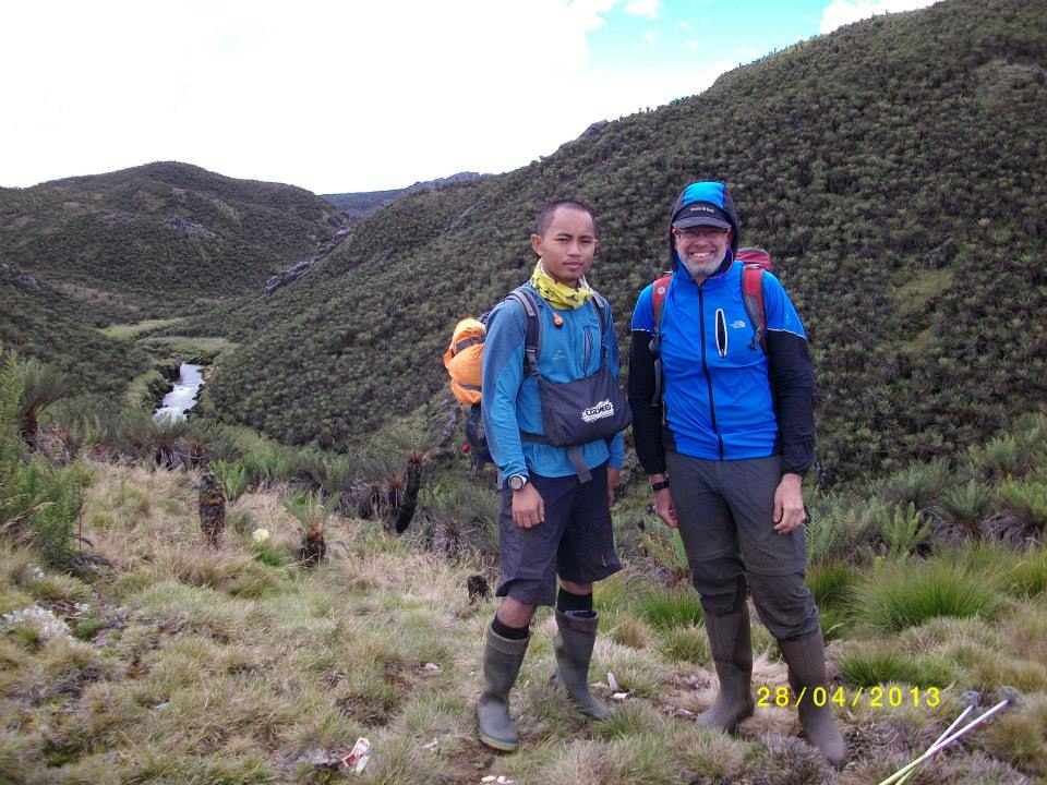
Upcoming Trips, Expeditions, Trekking and Safari

CLICK HERE for current expedition calendars

CLICK HERE to request more information
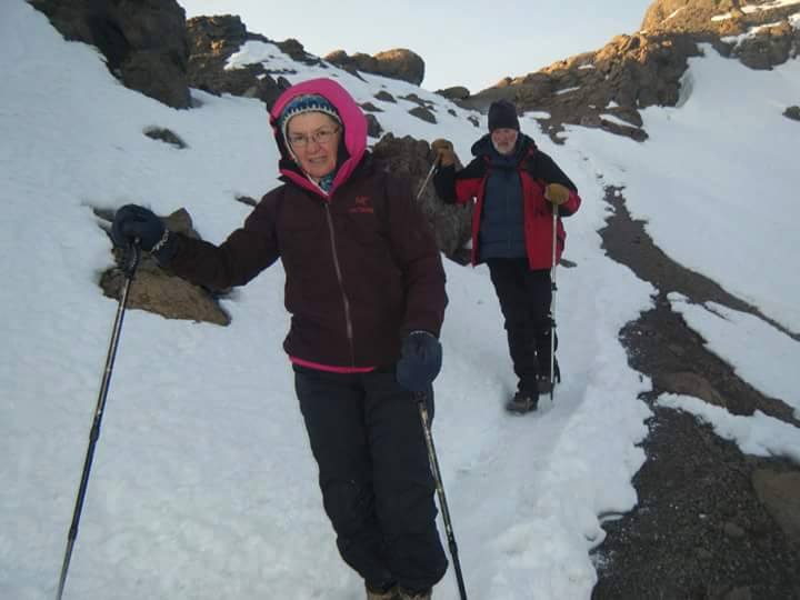
Kiilimanjaro near the summit of the Roof of Africa, one of the best to be your first Seven Summits
Day One: Machame Gate (1,800m/5,905ft) to Machame Camp (3,000m/9,840ft)
Elevation Gain: 1,200 meters, 3,935 feet
Distance: 10 kilometers
At 9am, leave Arusha for Machame Gate, where you will meet the porters, guides, and cooks that will spend the next seven days trekking with you to Uhuru Peak, the roof of Africa. The drive through coffee farms and villages to Machame Gate takes about 1.5 hours. Once you arrive, wait at the gate while your head guide registers your climb and the porters and guides make final preparations.
Your destination is Machame Camp. Each day, porters and cooks will walk ahead to set up the camp in time for your arrival. On the first day, hike through the moss-covered trees of Kilimanjaro’s cloud forest. The forest will thin at the end of the hike and vegetation will change to include heathers, tall grasses and wildflowers. If the weather is clear, view the surrounding area and your ultimate destination, Kibo Peak.
Day Two: Machame Camp (3,000m/9,840ft) to Shira Camp (3,840m/12,600ft)
Elevation Gain: 840 meters, 2,760 feet
Distance: 7 kilometers
Although considered to be the easiest day on the Machame Route, today’s trek includes several uphill sections. Carry plenty of drinking water, as the exposed hike can be hot on a clear day. There are several viewpoints from which you can see the plains and forests below and Kibo and Mawenzi peaks above.
As you gain altitude, notice the change in vegetation. The trees diminish in size, giving way to Kilimanjaro’s famous high altitude plants, Scenecio kilimanjari and Lobelia deckenii. After eating lunch, climb the Shira Plateau, created when Kibo’s lava flows filled the Shira crater. Continue to Shira Camp, where you will relax for the rest of the day. Kibo lies to the west and Mount Meru to the east.
Day Three: Shira Camp (3,840m/12,600ft) to Barranco Camp (3,950m/12,960ft)
Total Elevation Gain: 690 meters, 2,264 feet
Distance: 10 kilometers
Although this up and down day ends with an elevation gain of only 110 meters, by early afternoon you will have climbed 690 meters to a height of 4,530 meters before beginning your descent to Barranco Camp. This day is crucial for acclimatization.
After breakfast, hike east on the Shira Plateau before reaching the junction for the Shira and Lemosho Routes. Continue on through the barren landscape before stopping for lunch. Shortly after lunch, reach the highest point of the day before descending quickly to Barranco Camp. Faster hikers can take a detour via Lava Tower, a 300-foot lava formation jutting out of the mountainside.
Barranco Camp, set among stands of Senecio kilimanjari, is considered to be the most scenic campsite on the Machame Route.
Day Four: Barranco Camp (3,950m/12,960ft) to Karanga Valley (4,200m/13,780ft)
Elevation Gain: 250 meters, 820 feet
Distance: 7 Kilometers
Leave Barranco Camp after breakfast for Karanga Valley. The day begins with a 1.5 hour scramble up Barranco Wall. This is the hardest part of the day and in some places you will have to use your hands to pull your body up. After reaching the top make a short descent into the greener Karanga Valley. We generally camp on the ridge above the valley to allow for greater acclimatization.
Day Five: Karanga Valley (4,200m/13,780ft) to Barafu Camp (4,600m/15,100ft)
Elevation Gain: 400 meters, 1,320 feet
Distance: 6 kilometers
After breakfast, begin the hike to Barafu Camp. On the way to Barafu, view several of Kibo’s glaciers as well as the junction that connects the descent route, Mweka, with the Machame trail. During day four, hike by the Heim, Kersten and Decken Glaciers. Although the trail to Barafu passes through alpine desert with little vegetation, Barafu Camp offers stunning views of Kibo and Mawenzi peaks. Try to sleep as soon as you finish dinner as you will awake before midnight for your summit hike.
Day Six: Barafu Camp (4,600m/15,100ft) to Uhuru Peak (5,895m/19,340ft) to Mweka Camp (3,100m/10,170ft)
Elevation Gain: 1,295 meters, 4,240 feet
Elevation Loss: 2,795 meters, 9,170 feet
Distance: 18 kilometers
Around midnight, begin the final ascent to Uhuru Peak, the highest point in Africa. For the next six hours, hike by the light of your headlamp. The ascent to the crater rim is the most challenging part of the entire trek. The trail is very steep until you reach the crater rim at Stella Point.
The hike from Stella Point to Uhuru Peak is a gradual climb and, as far as hikes go, not very difficult. The altitude, however, makes the hike long and tiring. The crater rim hike takes approximately one hour. Upon reaching Uhuru, take photos of your guide and group at the peak before beginning the descent to Mweka Camp. On the way down from Uhuru, enjoy views of the mountain, crater, clouds and glaciers.
At Barafu Camp, eat breakfast and take a short break. You still have another three to five hours to go before reaching Mweka Camp.
Day Seven: Mweka Camp (3,100m/10,170ft) to Mweka Gate (1,500m/4,920ft)
Elevation Loss: 1,600 meters, 5,250 feet
Distance: 10 kilometers
After breakfast, finish the trek with a descent to Mweka Gate. Your last hike on Kilimanjaro is a beautiful one, passing through Kilimanjaro’s cloud forest. Watch your step during the descent, as the trail can be slippery. Vehicles will be waiting at the lower station of Mweka Gate to take you back to Arusha. You will be able to buy t-shirts and sodas at the gate.

Machame 7 Day Pricing

As of August 23, 2015
  • $2770.00 USD Complete as stated, note exceptions below.
  • $300.00 USD Deposit due upon reservation application
  • $2470.00 USD Balance due 30 days previous to arrival in Tanzania
Expedition includes 1 night hotel previous to your itinerary, and 1 night hotel after your itinerary.
Any combination of 2 through 5 Kilimanjaro packages = 7% discount
Any combination of 6 or more Kilimanjaro packages = 10% discount
I will contact you after your deposit with invoicing information
In a hurry? Kilimanjaro 6 Day Machame Trekking Option HERE

Deposit Now to Reserve Your Spot

Exceptions

  • Alcohol
  • Rescue and medical fees
  • Souvenirs, gifts, additional purchases
  • Tips, gratuities
  • Additional meals, snacks etc.
  • Expenses arising from itinerary exceptions or departures from itinerary
  • Trip insurance, additional expenses

Tuesday, August 18, 2015

Carstensz Expedition Helicopter Itinerary

Immediate Availability for a Helicopter Assisted Carstensz Pyramid Expedition November 10th. 

This is the shortest way to climb Carstensz and avoid the trek through Equatorial jungle. The cost for this upcoming expedition is actually less right now than if you were to book a regular trek through one of the larger expedition outfitters. You'd be amazed. Please contact me through the form ON THIS PAGE and I'll personally call you at your convenience to assist you in making the decision.

Go-Jek, motorcycle taxi outside Sugapa Village as we leave for our Carstensz Pyramid climb and expedition trekking

Expedition by Helicopter/Private Helicopter

Day 1: Arrival in Denpasar Bali
Day 2: Fly from Bali to Timika
Day 3: Fly from Timika to Basecamp
Day 4: Acclimatization at Basecamp
Day 5: Summit Day
Day 6: Fly to Timika
Day 7: Fly to Bali
Day 8: Depart Bali
See Trekking Itinerary above for more details.

Included in trekking expedition cost:

  • All required permits in Indonesia, Jakarta and Papua 
  • Airport transfers in Jakarta/Bali and Timika or Nabire 
  • Accommodation based on twin share in Bali, Timika, Nabire and camping 
  • Domestic flights (between Bali,Jakarta, Timika, Nabire as per itinerary) 
  • Chartered flight (between Timika, Ilaga, Nabire, Sugapa as per itinerary) 
  • Meals as per itinerary (B: Breakfast, L: Lunch, D: Dinner) 
  • Camping, dining, and cooking equipment (incl. cutlery) 
  • Camping gear (shared tent, kitchen equipment, dining tent,serving table, chairs) 
  • Experienced mountain guide, cook & field assistant 
  • Satellite Phone for guide’s group daily report and some emergencies 
  • Fixed rope maintenance on Carstensz Pyramid wall 
  • Porters up to 17kgs per client (that’s 37 lbs, pack as per instructions) 
  • Basically most expenses Bali to Bali 
  • Helicopter from Timika to Basecamp 
  • Helicopter from Basecamp to Timika

Not Included in trekking expedition cost:

  • Airfare to Bali and return to your home location 
  • Insurance 
  • Overweight on all flights 
  • Airport tax (about USD $20, but must be paid in Rupiah) 
  • Personal climbing and camping equipment 
  • Extra food and beverages (outside provided meals) 
  • Personal expenses (laundry, phone call, hotel minibar, SIM cards, etc) 
  • Evacuation or rescue cost 
  • Any additional expenses due to flight delay or cancellations 
  • Additional days in Bali waiting for flights home, etc. 
  • Indonesia Re-entry Visa USD $25/person – Visa Upon Arrival

Immediate Availability for Upcoming Trips:

Click to Book a Carstensz Pyramid Expedition Now

Descending in sleet after a successful climb of Carstensz Pyramid in 2013. Is it your turn?


Monday, August 17, 2015

Carstensz Pyramid Trekking Itinerary

18 Days Trekking Via Sugapa Village

Day 1: I recommend you arrive in Bali on an early flight to make best use of the day. In the evening there will be a welcome dinner. If you follow my instructions you won’t have to rearrange your gear to leave your flight bag. You should try to catch a nap.
Day 2: 11.00 PM check out. Yes, that’s 11 PM. We’ll be flying to Timika on the West Papua island at 12:15 AM. At 7:00 AM you’ll arrive in Timika. You’ll enjoy a breakfast, have a 2nd gear check, since Timika is the last place you can purchase some items that you might have misplaced or forgotten.
Day 3: You’ll take off in a small charter flight from Timika to the Sugapa-Bilogai airstrip. You’ll be taken to a local official’s hut where we’ll hire porters and distribute all of our gear. You’ll travel here by Go-Jek, the Indonesian motorcycle taxi. Hang on tight for the trip from Sugapa to the Muara river, where we’ll continue on foot to Suanggama, the last village we’ll be staying in.
Day 4: Trekking from Suanggama to Camp I
Day 5: Trekking from Camp I to Camp II (Enda Tsiga)
Day 6: Trekking from Camp II to Camp III (Ebay) [pronounced E-bai]
Day 7: Trekking from Camp III to Camp IV (Nasidome)
Day 8: Trekking to Carstensz Base Camp along the lakeshore.
Day 9: We’ll take off in the dark for our climb of Carstensz Pyramid, Puncak Jaya, the highest point of the Oceania continental group. We’ll spend the night again at basecamp.
Day10: Basecamp – Nasidome camp
Day11: Nasidome – Enda Tsiga [passing Ebay – making good time downhill with lighter loads]
Day12: Enda Tsiga – Camp I Riverside
Day13: Camp I Riverside – Sugapa
Day14: Fly out to NABIRE in small planes
Day15: fly to Bali via Kaimana-Ambon-Makassar or Jayapura (route depends on available flight and day returning). Some flexibility is required because we’re not exactly certain how long travel will actually be in these remote and primitive conditions. Hence the reserved days, below.
Day 16-18: Reserved days for bad weather, flight delay, etc. It’s an excellent idea to get a flight out on the 19th day, and have a relative or friend who can make a change for you and add a couple days if they do not get a confirmation message from you upon your arrival in Nabire or Bali. Bali is a beautiful place to spend a few days relaxing, with excellent scuba diving and water sports.
Me with one of our guides for Carstensz Pyramid Trek Expedition in 2013

Included in trekking expedition cost:

  • All required permits in Indonesia, Jakarta and Papua
  • Airport transfers in Jakarta/Bali and Timika or Nabire
  • Accommodation based on twin share in Bali, Timika, Nabire and camping
  • Domestic flights (between Bali,Jakarta, Timika, Nabire as per itinerary)
  • Chartered flight (between Timika, Ilaga, Nabire, Sugapa as per itinerary)
  • Meals as per itinerary (B: Breakfast, L: Lunch, D: Dinner)
  • Camping, dining, and cooking equipment (incl. cutlery)
  • Camping gear (shared tent, kitchen equipment, dining tent,serving table, chairs)
  • Experienced mountain guide, cook & field assistant
  • Satellite Phone for guide’s group daily report and some emergencies
  • Fixed rope maintenance on Carstensz Pyramid wall
  • Porters up to 17kgs per client (that’s 37 lbs, pack as per instructions)
  • Basically most expenses Bali to Bali

Not Included in trekking expedition cost:

  • Airfare to Bali and return to your home location
  • Insurance
  • Overweight on all flights
  • Airport tax (about USD $20, but must be paid in Rupiah)
  • Personal climbing and camping equipment
  • Extra food and beverages (outside provided meals)
  • Personal expenses (laundry, phone call, hotel minibar, SIM cards, etc)
  • Evacuation or rescue cost
  • Any additional expenses due to flight delay or cancellations
  • Additional days in Bali waiting for flights home, etc.
  • Indonesia Re-entry Visa USD $25/person – Visa Upon Arrival
Go-Jek, motorcycle taxi outside Sugapa Village as we leave for our Carstensz Pyramid climb and expedition trekking

Immediate Availability for Upcoming Trips:

Click to Book a Carstensz Pyramid Expedition Now

Wednesday, December 10, 2014

Seven Summits Quest Series on Amazon

The Seven Summits Quest Series on Amazon has been a persistently good seller from among all my books since I published the first one, Elbrus, My Waterloo.

Seven Summits Quest Series Click to check it out on Amazon.

Note that the book "Die Trying" by Bo Parfet comes up in this search. This book was instrumental in my decision to pursue the Seven Summits Quest and name my series. His experiences on Carstensz foreshadowed mine in several details.

Here are a few of the many 5-Star reviews:

I love the way this author writes! I suspect he keeps people in stitches and on the edge of their seats when he relates his adventures in real life. I love how he can be wry and make fun of things all while being serious and sharing real information. -- Orizaba

An unbelievable account that had me giggling, gasping, and in awe over what Mr. Miske went through. He made it easy to read for someone who knows absolutely nothing about climbing, I appreciated that. (Although I had to Google what "scree" was. Haha) Britney Spears makes an appearance, also some witty commentary that made me just shake my head at what life is like over there. Holy snot! It's an amazing story. Finished it in one sitting while sacrificing sleep. I had to see him home and safe first. :) -- Carstensz

This is really an excellent and enjoyable read. It's a detailed account of the author's attempt at climbing one of the Seven Summits. It's easier to write about one's successes but not always easy to put your failures out there for the world to see. The main point, I believe, is that "failure" isn't necessarily a bad thing. He didn't summit, but he got to experience things that the other 99% of us only dream about. Its pretty remarkable. Recommended for anyone who is considering taking on a mountain of this proportion, there is a lot of useful tidbits in there. Look forward to seeing "Owning Elbrus" from this author someday. -- Elbrus, My Waterloo

I read this an immediately turned around and had my pre-teen boys read it as well. Interspersed with the adventure itself are some great survival in the cold techniques that will make their Klondike outing with the scouts safer. I love that the author chases his dreams with a passion and shared the experience with a friend who was kind of a newbie at this. Their friendship also transpires through the book. -- Elbrus Race 2013


Help me with Volume 5 - South America CLICK HERE


Seven Summits Quest - Volume 5 - South America - Kickstarter Trailer from Charles Miske on Vimeo.


Saturday, September 27, 2014

Seven Summits Quest Registration

If you're wanting to get the latest news and updates about my Seven Summits Quest, including the Volcanics, check out my Facebook Page, and while you're at it, sign up for my Email List so you can get first shot at all the various giveaways I've done over the past few years. Facebook trickles out the news so many people have responded that they heard about a sweepstakes when a friend posted that they won or whatever, and not from the page, even though I posted it on the page about a dozen times.

Don't miss another opportunity, and don't miss another article. Register now:


Thursday, December 5, 2013

Aconcagua 2012 Memories

Aconcagua in November 2012. I had gone on my second attempt at a solo summit, and due to some scheduling issues, late November seemed like the right time to go. Unfortunately the weather thought it would be a really bad time to go. Everything froze up in Confluencia, first camp on the Horcones approach to the normal route. The wind was pretty rough at Plaza de Mulas, the normal route base camp. It snowed and blowed every day I was there. Not sure if the weather was part of the problem, but my health deteriorated, and the Rangers didn't clear me to ascend past base camp and recommended I descend. I hung out for a few days to see what would happen, but the weather was bad enough that the Rangers also declared that no one should go above Camp One at about 16,000'.

Goal Zero Solar Charger and Battery Pack


Holy Snot! Only 79?

Purificup filtration, glacial sediment and ice and all that.

Half Mile visibility seemed about the norm

Water bottle frozen even after spending the night in my -20 bag

Yeah, about that visibility thing

Frozen water barrels at Plaza de Mulas made it tough to get water
I basically ran out of acclimatization time, since the Rangers promised they could open the upper mountain again about 3 days before I had to catch my plane. Take out the day to descend to Puenta Del Incas, a day to travel to Mendoza, and that left me a day to summit. No thanks. I took off for the long haul to Horcones Ranger Station in the blowing drifting snow and lower down gritty sand. I got there after the Ranger Station closed, but some Rangers cleaning up were able to call down for my ride and soon I was in the lodge again.

I did learn a lot about Aconcagua, in spite of not really being able to go past Base Camp this time. Last time I was near Camp One when I twisted my knee outrunning the lightning blast. I figured out a lot about how to use my Goal Zero Solar battery packs to keep my electronics charged and how to keep the water flowing in my Purificup Water Purifier in spite of ice and gritty minerals. Both of these skills were essential for when I successfully climbed Carstensz Pyramid in Indonesia [book] and finished the Elbrus Race 2013 [book].

I might be going back in 2014. If so, I'll keep you in the loop.


Tuesday, November 12, 2013

Relaxing at Elbrus Race 2013

In my book about Elbrus Race 2013 [more info] I talked about how we relaxed on our rest days by hanging out at the huts and talking and eating and drinking. One of my good friends that I met there, Svetlana, who is mentioned numerous times in the book, sent me this pic that totally sums up the feeling at the Barrels on Elbrus while resting and recovering from our runs.

Kilian Jornet resing with a hot drink at the Snowcat Graveyard
This was one of my favorite books to write about one of my favorite times on a mountain with good friends and fellow competitors. I'll be going back next year with my teammates Todd Gilles and Jen Hamilton. Check out our training progress at ElbrusRaceTeam on Blogspot.


Friday, April 22, 2011

Before Denali: 10 days to Anchorage

In 10 days I'll be flying in to Anchorage. Last night I fit my Black Diamond Sabretooth crampons to my Lowa 8000 Meter boots, and experimented with sock combinations with various insoles. I'm heading to Colorado to test them this weekend.

I went climbing with a friend, toproping at Rock Canyon by Provo, Utah. We did laps on a 5.7 - first time I've climbed outside on rock in about a year. Last time was on lovely granite up Boulder Canyon. Ahh, Rock Canyon crud ... photo below is Ryan just clearing the 2nd "crux".


I actually prefer the Draper Red Rock for lapping. Might get that in yet this week.

This past week I did two 5k running tests. First one was at 31:55 and the second at 29:00. I'm not a runner. I run because it gets my heart rate up. I'm feeling kind of tired now, so I'll be cutting back on my training just a bit to reload/refresh before I head out.

I'll try to put some more up here as I get stuff done.

Saturday, April 16, 2011

Northwest Buttress Route

I've been looking at the route in this book: High Alaska: A Historical Guide to Denali Mount Foraker and Mount Hunter, by Jonathan Waterman

High Alaska: A Historical Guide to Denali Mount Foraker and Mount Hunter

There are some really good pictures by the inimitable Bradford Washburn, with little lines on them (mostly correctly labeled) where the historical routes passed.

Perhaps it is because the Northwest Buttress leads to the North Peak instead of the higher South Peak that this moderately difficult ridge is seldom climbed. However it is a classic Alaskan route because it offers the full spectrum of climbing snow and ice cornices, a knife-edge ridge, couloirs, frost-fractured schist towers and pink-speckled granite. Last, but not least, it has an awe-inspiring view down the biggest wall in the world and across the vast Alaskan tundra.

Our anticipated route has the following elevations:

Plane Lands: 7,200'
Glacier Low Point: 6,700'
Kahiltna Pass: 10,000'
Peters Glacier, foot of Northwest Buttress: 7,800'
North Summit: 19,500'
Camp between summits: 18,500'
South Summit: 20,320'
Plane Pickup: 7,200'

The ridgeline should involve a couple thousand feet of up and down as we ascend the various peaks and spires along it, so we'll probably have to ascend over 15,000' from our plane dropoff.