Thursday, December 5, 2013

Aconcagua 2012 Memories

Aconcagua in November 2012. I had gone on my second attempt at a solo summit, and due to some scheduling issues, late November seemed like the right time to go. Unfortunately the weather thought it would be a really bad time to go. Everything froze up in Confluencia, first camp on the Horcones approach to the normal route. The wind was pretty rough at Plaza de Mulas, the normal route base camp. It snowed and blowed every day I was there. Not sure if the weather was part of the problem, but my health deteriorated, and the Rangers didn't clear me to ascend past base camp and recommended I descend. I hung out for a few days to see what would happen, but the weather was bad enough that the Rangers also declared that no one should go above Camp One at about 16,000'.

Goal Zero Solar Charger and Battery Pack


Holy Snot! Only 79?

Purificup filtration, glacial sediment and ice and all that.

Half Mile visibility seemed about the norm

Water bottle frozen even after spending the night in my -20 bag

Yeah, about that visibility thing

Frozen water barrels at Plaza de Mulas made it tough to get water
I basically ran out of acclimatization time, since the Rangers promised they could open the upper mountain again about 3 days before I had to catch my plane. Take out the day to descend to Puenta Del Incas, a day to travel to Mendoza, and that left me a day to summit. No thanks. I took off for the long haul to Horcones Ranger Station in the blowing drifting snow and lower down gritty sand. I got there after the Ranger Station closed, but some Rangers cleaning up were able to call down for my ride and soon I was in the lodge again.

I did learn a lot about Aconcagua, in spite of not really being able to go past Base Camp this time. Last time I was near Camp One when I twisted my knee outrunning the lightning blast. I figured out a lot about how to use my Goal Zero Solar battery packs to keep my electronics charged and how to keep the water flowing in my Purificup Water Purifier in spite of ice and gritty minerals. Both of these skills were essential for when I successfully climbed Carstensz Pyramid in Indonesia [book] and finished the Elbrus Race 2013 [book].

I might be going back in 2014. If so, I'll keep you in the loop.


Tuesday, November 12, 2013

Relaxing at Elbrus Race 2013

In my book about Elbrus Race 2013 [more info] I talked about how we relaxed on our rest days by hanging out at the huts and talking and eating and drinking. One of my good friends that I met there, Svetlana, who is mentioned numerous times in the book, sent me this pic that totally sums up the feeling at the Barrels on Elbrus while resting and recovering from our runs.

Kilian Jornet resing with a hot drink at the Snowcat Graveyard
This was one of my favorite books to write about one of my favorite times on a mountain with good friends and fellow competitors. I'll be going back next year with my teammates Todd Gilles and Jen Hamilton. Check out our training progress at ElbrusRaceTeam on Blogspot.


Thursday, August 29, 2013

New 8000 meter peaks?

I guess Nepal has finally let the cat out of the bag and revealed several new 8000 meter peaks you can buy permits for. I think this article said there will be 5 to start with, and "many" of them have summits "way above 26,000'"

As far as I know there are 14 recognized 8000 meter peaks. I'm curious where these have been hiding and if the 14x8km climbers will have to come out of retirement.


Wednesday, August 28, 2013

Standing at the Equator - November 2008

I went with Mountain Madness for an Ecuador Volcano Climb. We went to the Equator museums and displays and had a great fun day as part of the acclimatization process. We climbed Illiniza Norte and Illiniza Sur, but when we went to do Antisana found conditions to be too dangerous with heavy slab over loose hoar so we didn't climb it. Sur was my high altitude mark at 17,218'

Sunday, July 28, 2013

High Altitude Success Secret: Beards

THIS ARTICLE is based on a study done by the Wisconsin Institute of Physiological Performance Science in which oxygen utilization by mountaineers on Everest was examined. The oddball result of this:

By 7,500 metres, the bearded sample showed, on average, a 7.3% rise in ORI compared to the clean-shaven mountaineers, by 8,000 metres, the gap had grown to 10.7% and on the summit, bearded climbers were processing oxygen almost 15% more efficiently, a differential which could mean the difference between life and death in Everest's harsh climate.
So apparently, there is a positive effect of allowing your beard to grow out while on a mountain. Since the subjects of the study were encouraged to grow or not grow facial hair, the potential for chicken/egg effect was diminished. In this case you would be left wondering:


  • A) do climbers who allow their beards to grow become more efficient at utilizing oxygen?
  • B) are climbers who are better at utilizing oxygen naturally more inclined to let their facial hair grow?

Letting my beard grow for the cause


Trail running at 9,600' with facial hair for better oxygen utilization
Since I had my first over-exposure to a biting cold wind on Rainier in April of 2007, I have had to allow my beard to just do its own thing. I trim it with electric clippers to a very short 1/32" about every two weeks In the meantime it can become as long as 5/16" if I'm eating normally. I think protein consumption and exertion or training levels do have some impact on this.

I have to say that on every one of my speed runs on a Colorado 14'er I have been a bit on the shaggy side. I have also had great success on Kilimanjaro, Orizaba, and Carstensz with a fair amount of facial hair. Based on my own anecdotal evidence, I suspect there is something to this theory. I hope to hear more positive mountaineering results obtained from other lapses in hygiene...

Resting in the tent to allow the best possible facial hair growth

Wednesday, July 3, 2013

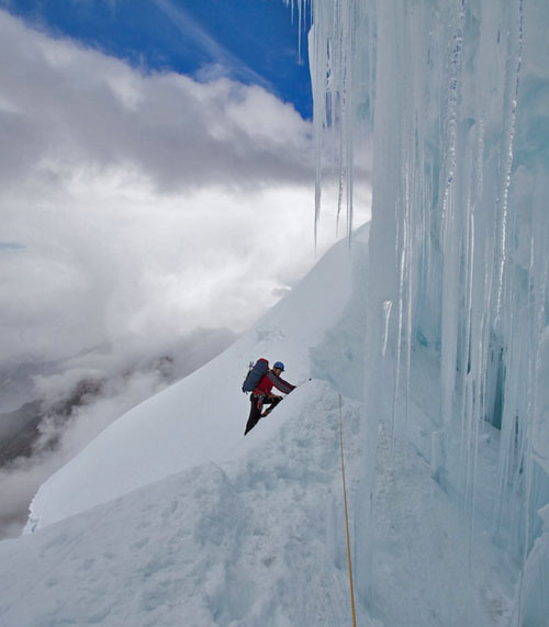
Alpamayo Gear List

From the San Juan Mountain Guides Website, here's the gear list for Alpamayo:

6000 Meter Double Boots with Crampons

General Equipment

Duffel Bag: Large durable bag for airline and in-country travel and organization.
Backpack: Internal frame, 50-60 liters max. Guides’ pick: Osprey Aether 60 or Variant 52
Sleeping bag: Down or synthetic bag rated between 15-20 degrees with compression stuff sack. Guides’ pick: Neutrino Endurance 400
Sleeping Pad:  Full-length Therm-a-Rest air mattress.
Pocket knife: 2-3 inch blade, simple, light
Cup/Bowl & Spoon:  Versatile plastic/lexan type.
Small thermos: Optional, but nice to have
Water bottles: 2 liters combined capacity; bottles or bladder. Guides’ pick: Nalgene or Platypus
Water Bottle Insulators: OR or similar sleeve type water bottle insulators

Weighing gear in Talkeetna Alaska

Climbing Equipment

Adjustable Trekking Poles
Harness: Adjustable leg loops are essential.
Locking carabiner (2): Pear shaped, wide mouth.
Non-locking carabiners (4): Wire gate biners are best
Helmet
Boots: Climbing boots.  Double boots or insulated single boots with zippered gaiter.
Crampons: Step in crampons.  Guides’ Pick: BD Sabretooth
Ice Axes: 2 Technical Ice Tools.  Guides’ Pick: BD Cobra

Clothing and Personal Equipment

Travel Clothing: 2 sets of travel/town clothing is usually suffiicient
Hiking boots: Lightweight hiking boots or approach shoes for acclimatization hikes and around town.
Socks: 2-3 pair of medium weight wool or synthetic blend socks.
Base layers: Synthetic t-shirt and synthetic long underwear
Mid-weight Layer: For over your long underwear and under other external layers. Guides’ Pick: OR Centrifuge Jacket
Soft shell pants: Warm enough for cool mornings and nights, yet light enough for warm days. Guides’ Pick: OR Cirque Pant
Soft shell jacket: Your workhorse jacket with a hood. Guides’ Pick: OR Alibi Jacket
Insulated Jacket: Down or synthetic with a hood. Guides’ pick: OR Virtuoso Hoody
Hard shell jacket: waterproof and breathable, no insulation. Guides’ Pick: OR Axiom Jacket
Gloves: 3 pair. 1 mid-weight, 1 heavy-weight, 1 light-weight. Bring mittens if you get cold hands easily.
Hand Warmers: 2 – 3 packets to stick in your gloves.
Hats: one with brim, one for warmth
Balaclava: BUFF’s are also acceptable.
Sunglasses: With Category 4 lenses.
Goggles: A standard paid of ski goggles will suffice.
Sunscreen and lip balm: water/sweat-proof. SPF 50 or higher recommended.
Headlamp: with extra batteries. Guides’ pick: Black Diamond Spot
Toiletries: Toilet paper, baggie for used TP, toothbrush/paste, wet wipes, hand sanitizer, etc.
Personal first-aid kit: for your personal meds/needs; guide will have a large one as well
Stuff sacks: for convenient packing
Digital Camera
Book and/or iPod/iPad
Lunch food: Everything you eat between breakfast and dinner. May include: bagels, dried meats, cheese, trail mix, candy bars, peanut butter, etc…

Tuesday, July 2, 2013

Alpamayo Itinerary

It's not one of the Seven, but I think it's one of the most beautiful mountains on our planet. For that reason alone I've decided to head to Peru and climb 19,512' Alpamayo. Summit day includes a couple thousand feet of steep snow and ice climbing up to 70 degrees or so. AI 2-3.


I'll be going with San Juan Mountain Guides in Ouray CO and for more information on this climb, and to reserve your spot for next year, [CLICK HERE]

Here is the itinerary as listed on their website:

DAY 1

Depart U.S. for Peru arriving late evening. We will be there to pick you up at the airport and transport you to our hotel near the US Embassy in the Mariscal Sur district.

DAY 2

Today we travel to the high mountain town of Huaraz (9,500 ft.), and our hotel accommodations for the evening.

DAY 3

In Huaraz, we organize equipment and food for our expedition.  This also serves as a valuable acclimatization day.

DAY 4

Drive to Cashapampa (9,000').  Along the way we will pass through many smaller Peruvian villages and enjoy beautiful views of many Cordillera Blanca peaks, including the massive Huascaran. We begin our trek up the lovely Santa Cruz Valley to camp at Illma Corral (11,500').

DAY 5

Another splendid day of trekking in the high Andes to reach our base camp (13,500') for Alpamayo.

DAY 6

We hike a load of equipment and supplies to camp 1 (moraine) and return to base camp.

DAY 7

Today we hike to and stay at moraine camp.

DAY 8

A rest and acclimatization day at moraine camp.

DAY 9

Today we will move to Camp 2, also known as Col Camp.  This is one of the more challenging days of the expedition, as we will be navigating crevasses and some steep two-tool climbing with heavier packs on the way to our camp at 18,000'.

DAY 10

Summit Day on Alpamayo (19,512').  After we cross the bergschrund it is approximately 7 – 9 pitches of 55 – 70 degree neve and ice climbing to the summit ridge and the top of this sought after peak.  We will rappel the route back to high camp.

DAY 11

Extra summit day or rest day at Col Camp.

DAY 12

Extra summit day on Alpamayo.  Alternatively and if the group is feeling strong, we may choose to climb Quitaraju (19,820') by it’s North Face.  Though not as steep as Alpamayo, the route is longer and crests the magical 6000 meter mark.

DAY 13

Descend to basecamp from Col Camp.

DAY 14

With the aid of horses we will descend from basecamp back to Cashapampa and continue to Huaraz.

DAY 15

Depart Huaraz and return to Lima.

DAY 16

Return to the US.

Photo and information from San Juan Mountain Guides website.

Wednesday, June 19, 2013

Everest News Farce

Just a quick comment on "news" written by non-climbers about climbing. I have read close to 100 articles bemoaning the sad state of affairs on Everest, about how too many people died there this year, and about the overcrowding and bottlenecks and how it's all a bunch of greedy overpaid business people on an adventure holiday, and it's not like it was in the old days with the jolly good groups of high ranked climbers doing it for the cause man...

Trail Running along the Blue River in Summit County CO
Training for Elbrus Race 2013
I think there are a few driving forces behind this rash of ignorant incendiary writing.

1) Google loves "new and fresh" articles of about 300-700 words with a certain ratio of keywords

Almost every one of these articles falls into that category. Panda and Penguin have pretty much screwed up the internet for people who really want to learn about stuff. Silly fluff articles will prevail.

2) Recent memoir re-hashing

Much like the Rolling Stones not being able to just give it up already, we have some ghost-written books out alleged to be by some of the few remaining survivors of ancient Everest history claiming superiority for their methods of climbing. Maybe it's too bold of me to say so, but they conveniently forget that they paid their hundreds of porters what amounts to mere pennies per day. That the huge siege on the mountain built a pyramid of logistics on the backs of those hundreds of porters and sherpa to get two guys to the top. I'm not convinced those ethics are any better than the current standard on Everest. (this isn't directed at the few near-alpine style ascents rare and uncommon in Everest history)

3) Non-climbers and armchair mountaineers love to bash Everest

Enough said - if it's about Everest and it's negative, they'll eat it up. Sells ad space.

4) Time delay writing

These really sound like they were written about last year (2012 season) during which there were too many deaths and too many bottlenecks. They probably assumed that the whole thing would escalate, wrote these in January and set a timer for "early June" and let it auto publish.

Summit of Carstensz Pyramid in Oceania
One of the Seven Summits
Ironically, I think this was one of the safest years on Everest in recent times. Aside from the whole rock throwing incident. Big weather window. Very little bottle-necking. Few deaths. Those are the facts that have me questioning these articles.

How about you? Do you think I have these articles pegged? Or is there something I'm missing? Let me know...

Thursday, May 30, 2013

Carstensz Summit Photo

Carstensz Summit at 11:00 AM of 30 April 2013. Wrote about the amazing adventure in my book "Carstensz, Stone Age to Iron Age" [CLICK TO BUY] - the name makes sense when you consider the contrast between my experiences dealing with the groups from ancient and modern history and their respective attitudes on things.

Myself, bottom left, at the summit of Carstensz


"I've read Mr. Miske's other books and this is his best yet. It was great to see him make this summit, especially with everything that went on. The environment, the politics, the locals, the weather, the mud, the injuries, the exposure and terrain..its just unreal what the author went through to get this summit! Just read it. 5 stars!" -- Book Review on Amazon


Sunday, March 31, 2013

Climbing Groups and Guide Services

Guide Companies:
Andean Face Local Ecuador Guide Company
International Mountain Guides
Mountain Madness Guide Company
Rainier Mountaineering Inc. Expeditions
San Juan Mountain Guides
Mountain Trip
Alaska Mountaineering School

I have used each of these guide companies at one time or another, and can vouch for their excellent service.

Message Boards:
Cascade Climbers
Summit Post
Colorado 14'ers
Mountain Project

I have been active more or less on each of these. You can find route info, friends to climb with, and gear to buy and sell on most of these if you dig in the forums.

Tuesday, March 19, 2013

Orizaba Summit Photo

March 5 2013 5:10 pm. Summit of Orizaba highest volcano in North America and one of the Volcanic Seven Summits.

Wednesday, March 13, 2013

Orizaba - the highest mountain in Mexico - GPS Track

My friend Todd and I did Orizaba, the highest mountain in Mexico, third highest in North America, and the highest volcano in North America, making it one of the Volcanic Seven Summits. At approximately 18,500' it's usually not a walk in the park, though we did manage to summit on our first acclimatization hike, where we planned to stop either below or above the Labyrinth. We felt so good we kept on going and hit the top at about 5:10 PM. We descended in the dark, getting lost in the Labyrinth and the cliffs below, apparently, from this Spot GPS track [SPOT Connect], going too far to climber's left of the proper track. During our "lost in the dark" phase I was pretty sure we were too far to the right. We eventually moved in the correct direction and ended up crossing a familiar line of cairns and followed them down the way we'd come up, after a lot of mental wear and tear trying hard not to fall off a cliff in the dark.


Picture above shows me climbing through the mixed rock snow ice gravel of the Labyrinth. Balanced rock above is the landmark we used for the descent in the dark, and is at the ridge where the Labyrinth trail turns and goes to the foot of the Jamapa Glacier. Here is the GPS track as waypoints, not paths, the way that SPOT uses by default from their admin page.